 by
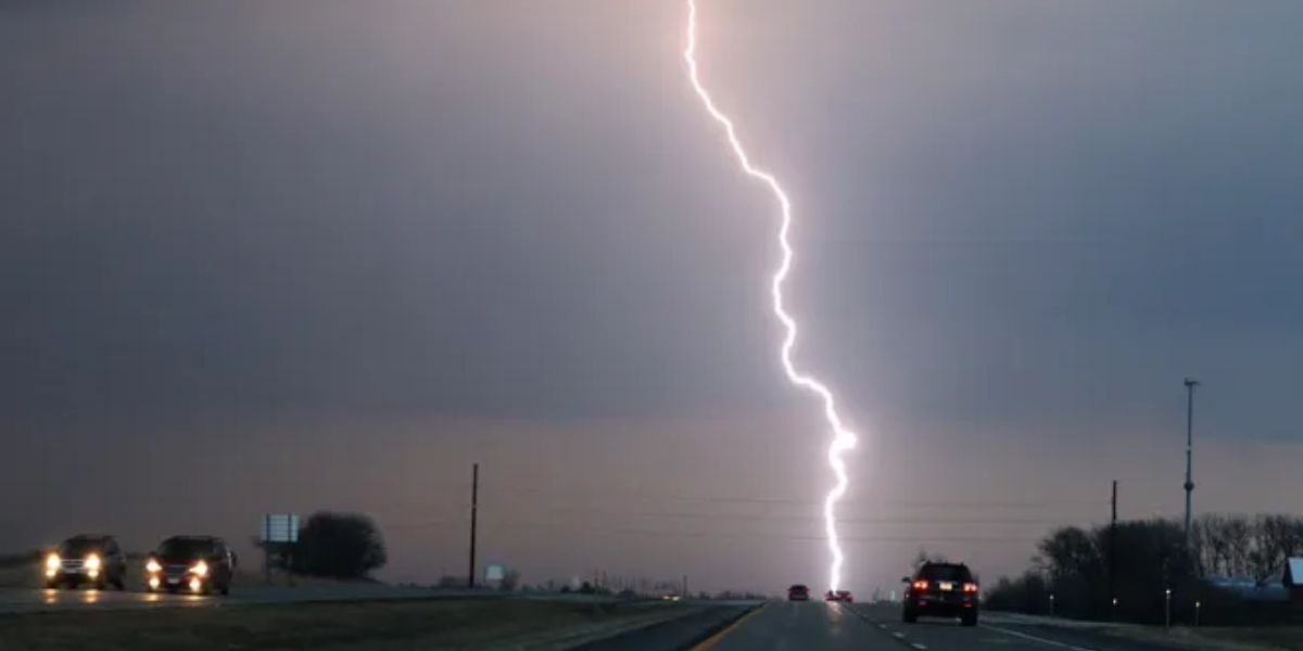
by Drivers and residents across western and central Kansas should prepare for a wet and stormy weekend, as multiple rounds of heavy rain and thunderstorms are forecast from late Friday night through Sunday. The National Weather Service in Dodge City has issued warnings about rapidly shifting rainfall patterns that could create travel hazards and localized flooding throughout the region.
Storms to Spread Eastward Into Central Kansas
Rain is expected to begin late Friday night in far western Kansas before gradually spreading eastward into cities such as Dodge City, Garden City, Liberal, and Pratt by Saturday night. The most widespread weather impact is likely Saturday evening, when numerous storms will move across central and southwestern Kansas. These storms could bring brief but intense rainfall, gusty winds, lightning, and reduced visibility along highways including US-50, US-54, and US-283.
Localized Flooding a Concern Due to Uneven Rainfall
A key concern with this weather system is the highly variable nature of rainfall. While one town might receive several inches of rain, a nearby area may only see light showers. This uneven distribution can result in sudden street flooding, especially in low-lying areas, urban centers, or places where storm drains are blocked. Rural roads are also at risk of ponding water and erosion.
Travel Warnings for Saturday Night
Drivers planning to travel on Saturday night should be especially cautious. Wet roads, standing water, and heavy downpours can make driving treacherous. The risk of hydroplaning increases during intense rain, and visibility can quickly decrease during storm bursts. Motorists are advised to avoid flooded roads, even if water appears shallow, as just a small amount of moving water can stall or sweep away a vehicle.
Safety Precautions and Travel Tips
Residents are encouraged to prepare in advance by charging mobile phones, checking weather alerts, and securing outdoor furniture or equipment that could be damaged by wind or rain. For those with weekend plans, it’s wise to monitor forecasts regularly and confirm event schedules, as some areas may remain dry while others could face sudden weather disruptions.
Lingering Storms Expected Sunday
Scattered thunderstorms are expected to continue into Sunday across central Kansas, though their coverage and intensity may begin to taper off. However, brief periods of rain, lightning, and wind gusts are still possible. While not classified as a severe weather outbreak, the ongoing storms may still cause delays and disruptions, especially for outdoor activities and travel.
Stay Updated with Local Forecasts
With conditions expected to remain unsettled throughout the weekend, officials recommend checking in frequently with local news outlets, the National Weather Service, and the Kansas Department of Transportation (KDOT) for updated alerts, road closures, and safety information. Staying informed is key to navigating this active weather period safely.