 by
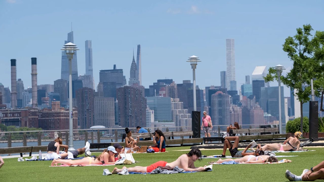
by NEW YORK CITY, N.Y. – Residents across New York and New Jersey can look forward to a stretch of sunny skies and seasonably warm temperatures as a high-pressure system settles over the region. Starting Sunday and continuing through at least Tuesday, the area will enjoy mostly clear skies, comfortable humidity, and mild summer heat.
According to forecasters at PIX11, the weather is shaping up to be ideal for outdoor plans, particularly in the early mornings and late evenings when conditions will feel especially pleasant.
Sunday Weather Outlook
Sunday will bring low humidity levels, making the warmth feel far more tolerable compared to the muggy stretches common in July. Afternoon highs are expected to climb into the low to mid-80s, providing ideal conditions for beach trips, park outings, and open-air events across both states.
“Expect mostly sunny skies and seasonably warm conditions,” the PIX11 Weather Center said in its latest forecast.
Winds will be light and variable, and no precipitation is expected through the evening hours. UV levels will remain elevated during peak hours, so residents are encouraged to wear sunscreen, stay hydrated, and seek shade periodically.
Warming Trend Begins Monday
The warming trend will continue into Monday, as temperatures begin to climb into the mid-to-upper 80s across much of the tri-state area. While humidity is expected to remain in a comfortable range, meteorologists note that urban centers like Manhattan, Newark, and Jersey City may feel slightly warmer due to urban heat island effects.
“Warmer conditions are in store for tomorrow,” PIX11 reported, adding that the skies will remain largely clear, with only passing clouds expected in the late afternoon.
The pleasant conditions make it a great start to the workweek, especially for commuters and students heading back to schools and campuses.
Tuesday Brings More Sunshine, Possible Afternoon Clouds
Tuesday will begin with bright skies and cool morning lows in the 60s, providing a refreshing start before the sun intensifies in the afternoon. Highs in the mid-80s are forecasted, but cloud cover may increase slightly during the latter part of the day.
Still, no significant weather systems are expected to impact the region, and the chance of rain remains very low. These calm conditions are part of a dominant high-pressure ridge, which has brought atmospheric stability to the Northeast.
Great Time for Outdoor Activities
Whether it’s walking the Brooklyn Bridge, biking through Liberty State Park, boating on the Hudson, or enjoying the Jersey Shore, the coming days offer a rare chance in August for enjoyable weather without stifling humidity.
Evening conditions will be especially pleasant, with low dew points making for clear, crisp nights, ideal for stargazing or simply winding down outdoors.
When Will Conditions Change?
Long-range forecasts suggest that more humid and unsettled conditions may return by Wednesday night into Thursday, as a cold front moves across the Great Lakes region, potentially bringing showers and thunderstorms by midweek. However, details remain uncertain, and models may shift.
Until then, this brief window of warm, dry, and sunny weather is likely the best stretch of summer conditions for the week ahead.
What are your thoughts on this weather update? Share your comments and stay tuned to our website for the latest updates.