 by
by Colorado Springs, Colorado — Southern Colorado starts the day under calm skies and unexpectedly mild air, creating a quiet and almost misleading sense of early winter comfort. Dry pavement, light winds, and thinning clouds greet drivers heading out on post-Christmas trips, especially along the busy I-25 corridor. But forecasters say the calm won’t last.
While the region enjoys a stretch of unusually warm weather through Saturday, a noticeable winter shift is expected late Saturday night into Sunday, bringing colder air and a growing chance of snow that could impact travel.
Mild and Quiet Conditions Through Friday
For now, conditions remain favorable across much of southern Colorado. Sunshine dominates areas including Colorado Springs and Pueblo, helping temperatures climb into the mid to upper 60s, well above seasonal averages. Winds stay light, keeping travel conditions smooth and predictable along I-25.
Overnight lows dip into the 30s, but widespread freezing issues remain limited. Roads stay dry, and early morning travel should not face major hazards through Friday.
Saturday Feels More Like Fall Than Winter
Saturday continues the mild pattern. Skies remain mostly sunny, and afternoon highs still approach near 60 degrees, making it feel more like early fall than late December. Outdoor plans and regional travel remain largely unaffected, with no precipitation expected during the daytime hours.
This warmth, however, plays a role in what comes next. As colder air begins pushing south late in the day, atmospheric conditions start to change quickly after sunset.
Snow Chance Develops Saturday Night
By Saturday night, cloud cover increases and temperatures drop sharply. Forecasters say snow showers could begin developing after sunset, first over higher elevations and then spreading toward the Colorado Springs and Pueblo areas.
Read Also: Post-Christmas Weather Alert: More Snow and Ice Headed for the Northeast
While roadways may stay mostly dry at the onset, rapid cooling could allow moisture to freeze quickly, especially on bridges, overpasses, and less-traveled surfaces. Even light snow combined with falling temperatures can create isolated icy patches.
Sunday Brings a Sharper Winter Feel
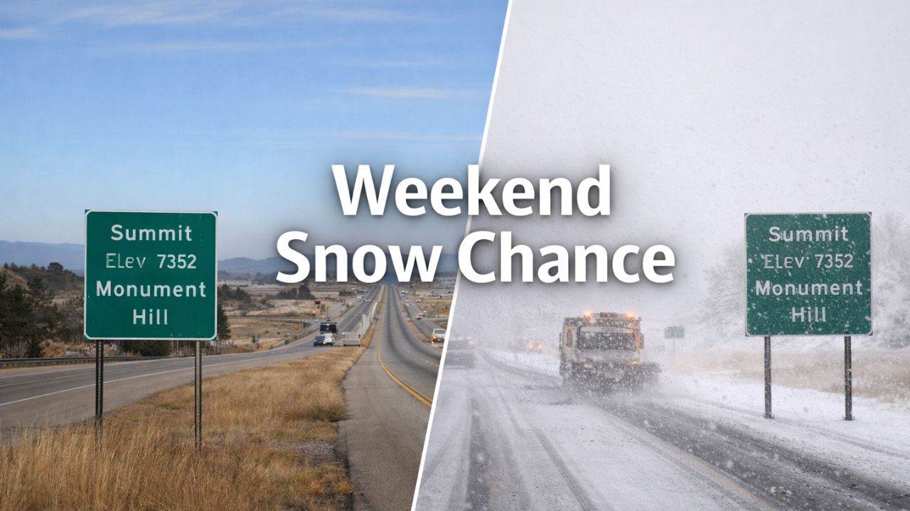
Sunday marks the most noticeable shift of the weekend. Daytime highs fall into the low 30s, and snow showers become more likely across southern Colorado. Accumulations are expected to remain light, but visibility may drop briefly during passing snow bands.
For travelers, conditions along I-25 could deteriorate quickly, particularly through Monument Hill and other elevated stretches where snow tends to accumulate faster. Gusty winds are not a major concern, but cold pavement and intermittent snowfall may still create slick driving conditions.
Drivers are encouraged to allow extra travel time, monitor road conditions closely, and be prepared for changing weather during the day.
What Travelers Should Keep in Mind
- Dry, mild travel through Saturday afternoon
- Snow chances increase Saturday night
- Colder temperatures and snow showers Sunday
- Greatest travel concern along elevated portions of I-25
While this does not appear to be a major winter storm, even minor snowfall can cause outsized impacts during busy travel periods.
As southern Colorado transitions from deceptive warmth to winter conditions, staying weather-aware will be key for anyone heading out on the roads this weekend.
Are you traveling along I-25 this weekend, or already seeing changes where you live? Share your local conditions in the comments below.