 by
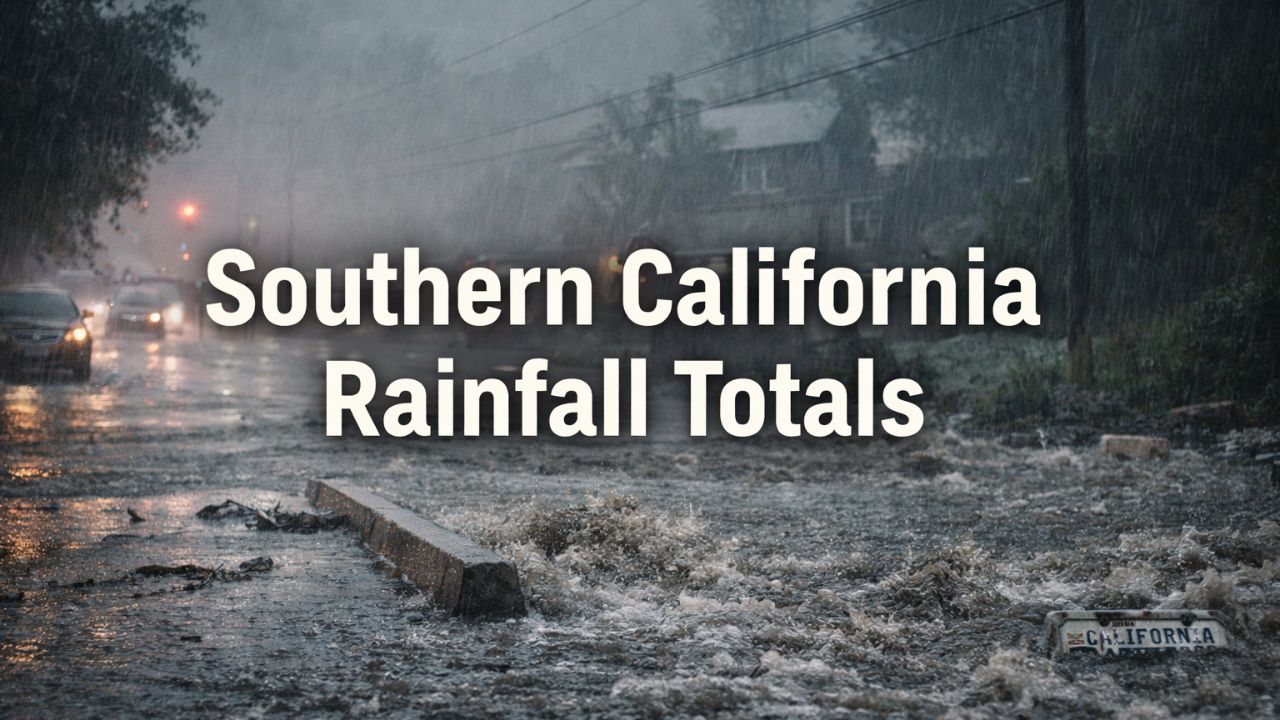
by Los Angeles, California — A powerful atmospheric river continues to drench Southern California, with updated rainfall totals revealing extraordinary precipitation across coastal, valley, and mountain communities as the storm enters its most intense phase during the Christmas holiday period.
The National Weather Service released updated 48-hour rainfall totals Thursday morning, confirming that several locations had already received half a foot of rain by Wednesday afternoon, with totals climbing sharply overnight. Forecasters warn that rainfall will continue through Thursday and Friday, keeping flood risks elevated across much of the region.
Foot-Plus Rainfall Recorded in Foothills and Mountains
Some of the most dramatic totals were reported in the Los Angeles County foothills and mountains, where more than 12 inches of rain has already fallen in parts of the San Gabriel Mountains.
Locations such as San Gabriel Dam (12.43 inches) and Crystal Lake (12.13 inches) exceeded a foot of rainfall, with several other mountain sites reporting 6 to 8 inches. These totals raise serious concerns for mudslides, debris flows, and flash flooding, especially in burn-scar areas.
Meteorologists emphasized that the mountains are acting as rainfall amplifiers, intensifying runoff into downstream communities.
Widespread Heavy Rain Across Los Angeles County
Rainfall has been substantial across nearly all parts of Los Angeles County. In metropolitan areas, totals ranged from 2 to 3.5 inches, including Downtown Los Angeles (2.66 inches), Hollywood (2.66 inches), and Bel Air (3.12 inches).
The San Fernando and Santa Clarita valleys saw even higher amounts, with Newhall (5.98 inches), Pacoima (5.51 inches), and Canoga Park (5.47 inches) among the hardest-hit locations.
Even the Antelope Valley desert region was not spared, with Lancaster (2.22 inches) and Palmdale (1.89 inches) receiving unusually high rainfall for arid areas.
Ventura County Sees Dangerous Mountain Totals
Ventura County recorded some of the highest storm totals outside Los Angeles County, particularly in mountainous terrain.
Old Man Mountain (10.83 inches) and Nordhoff Ridge (9.09 inches) approached foot-level rainfall, while coastal communities such as La Conchita (4.26 inches) and Oxnard (4.12 inches) experienced soaking rains that led to street flooding and runoff issues.
Western and eastern valleys, including Ojai (6.70 inches) and Simi Valley (5.91 inches), also saw significant accumulation.
Orange County and Inland Empire Continue to Fill Basins
Orange County rainfall totals ranged from 1.5 to over 4.5 inches, with the Santa Ana Mountains recording the highest amounts. Upper Silverado Canyon (4.68 inches) and Coldwater Canyon (4.13 inches) led the county.
In San Bernardino County, mountain areas again dominated totals. Middle Fork Lytle Creek (12.32 inches) and Wrightwood (9.89 inches) ranked among the wettest locations regionwide. Valleys generally saw 2 to 4 inches, while high desert communities experienced 1 to nearly 6 inches, including Mojave Forks Dam (5.86 inches).
Riverside County Rainfall Lower but Still Impactful
Riverside County recorded lighter totals overall, but still enough to cause issues in vulnerable areas. Valley locations mostly ranged between 0.5 and 2.5 inches, while mountain communities like Mount San Jacinto (2.99 inches) and Idyllwild-area sites (2.64 inches) picked up more substantial rainfall.
Even the Coachella Valley, typically shielded from major rain events, saw measurable totals, including Morongo Valley (1.70 inches) and Palm Springs Airport (0.44 inches).
Read Also: Holiday Travel Warning: Icy Conditions Likely in Northern Michigan
Storm Not Over as Flood Risk Remains High
Forecasters stress that the storm is far from finished. The National Weather Service describes the system as a “long-duration atmospheric river event”, warning that Christmas Eve and Christmas Day are expected to bring the heaviest rainfall.
According to NWS guidance, two additional storm impulses are expected to move through the region Thursday and Friday, bringing periods of heavy rain and a slight chance of thunderstorms.
Key concerns remain:
- Flash flooding in urban areas
- Mudslides and debris flows near burn scars
- Rapid runoff from saturated soils
- Road closures and travel disruptions
Showers are expected to taper late Friday evening, with drier and warmer weather returning over the weekend and into next week.
What Residents Should Do Now
Emergency officials urge residents to remain vigilant, especially those near creeks, canyons, and foothill communities. Avoid flooded roadways, monitor local alerts, and prepare for rapidly changing conditions, particularly overnight.
As multiple atmospheric rivers continue to impact California during a record holiday travel period, authorities say the risk window remains open until rainfall fully subsides.
Are you seeing flooding or unusually high rainfall where you live? Share your local conditions and experiences in the comments below.