 by
by Southern California, CA – Southern California is set to ring in the New Year under cloudy skies and steady rainfall as another Pacific storm moves into the region, ending a brief stretch of dry and sunny weather. Meteorologists say the incoming system will arrive while the ground remains saturated from last week’s atmospheric river, raising renewed concerns about travel disruptions and localized flooding as 2025 comes to a close.
According to the National Weather Service, rain will begin developing Tuesday evening along the Central Coast before gradually spreading east and south into Los Angeles, Orange County, and surrounding areas overnight. Conditions are expected to deteriorate further on Wednesday, with the most widespread and impactful rainfall arriving Wednesday night and continuing through New Year’s Eve and New Year’s Day.
Forecasters say this storm will not be as intense as the recent atmospheric river event, but it is still expected to bring meaningful rainfall over a short period of time. Peak rainfall rates between 0.25 and 0.50 inches per hour are possible during the heaviest bands, with isolated downpours exceeding those rates in localized areas.
Heaviest Rain Expected Over Holiday Celebrations
The National Weather Service identifies Wednesday night through Thursday as the most active window of this system. During this period, rain could fall steadily for several hours, particularly across metro Los Angeles and foothill communities. While the storm is forecast to be at least 50 percent lighter than the last major event, officials caution that even moderate rainfall could cause problems given already saturated soils.
Projected rainfall totals through New Year’s Day are expected to range from 1.25 to 1.5 inches across much of the region. Heavier totals are possible in foothill and mountain areas, where runoff tends to accelerate more quickly.
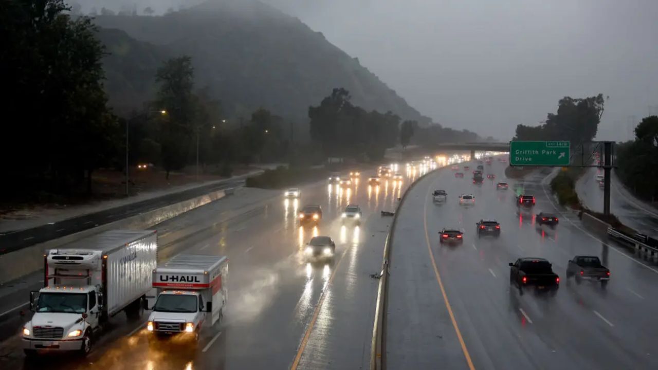
Meteorologists say most major rivers and flood control channels should be able to handle the incoming rain. However, ponding on roadways, slick travel conditions, and minor flooding in low-lying or poorly drained areas remain possible, especially during peak rainfall overnight.
Outdoor Events Impacted by Weather Concerns
The approaching storm has already prompted changes to holiday plans. The City of Fullerton announced it would cancel its large outdoor New Year’s Eve celebration, citing concerns over public safety and event operations.
“These conditions raise public safety and operational concerns for attractions, entertainment, and fireworks,” city officials said in a statement.
Read Also: North Carolina Weather Shift: Warm Weekend, Then Freeze Risk for New Year’s Travel
Other cities are closely monitoring forecasts as they determine whether scheduled outdoor events can safely proceed.
Rose Parade Attendees Should Prepare for Wet Conditions
Those planning to attend the Rose Parade in Pasadena are being urged to prepare for rain. Weather officials say the chances of rain during parade festivities — including the overnight hours when spectators traditionally camp along the route — are extremely high, estimated between 80 and 90 percent.
Rain during the iconic parade is a relatively rare occurrence. The last time measurable rain fell on the Rose Parade was 2006, nearly two decades ago.
Attendees should plan for wet pavement, cool temperatures, and periods of steady rain. Umbrellas are not permitted along the parade route, so ponchos, rain jackets, and waterproof footwear are strongly recommended.
Brief Lull, Then Another Round Possible
Forecasters say rainfall will taper to scattered showers Thursday night into Friday, providing a short break in steady precipitation. However, the pause may be temporary.
A second cold front from the northwest is expected to move toward Southern California late Friday into Saturday, bringing another round of rain. While confidence remains lower regarding exact amounts with the second system, meteorologists caution that additional showers could prolong wet conditions into the first weekend of 2026.
Whether that second round brings light, scattered rain or more organized precipitation will depend on how the system evolves offshore over the next several days.
Travel and Safety Considerations
Drivers are urged to plan ahead for New Year’s travel, particularly during nighttime hours when visibility may be reduced and roads become slick quickly. Officials advise slowing down, increasing following distance, and avoiding flooded roadways.
Residents in foothill and burn-scar areas should remain alert for changing conditions, even though widespread debris flows are not currently expected. Emergency officials stress that conditions can change rapidly if rainfall rates exceed forecasts.
Looking Ahead
While Southern California will close out 2025 on a wet note, long-range forecasts suggest a gradual drying trend may return after the weekend, though cooler temperatures could linger into early January.
For now, residents and visitors alike are encouraged to stay weather-aware, adjust outdoor plans as needed, and prepare for a rainy start to the New Year.
How are you planning to adjust your New Year’s plans with rain in the forecast? Share your thoughts and experiences in the comments.