 by
by Los Angeles, California — Southern California is preparing for another impactful winter storm this weekend as a new system moves into the region late Friday, bringing widespread rain, gusty winds, and accumulating mountain snow. Forecasters warn that the storm could pose flood risks near recent burn scars, while travel in higher elevations may become hazardous.
Meteorologists say this system is part of an ongoing active weather pattern that shows little sign of letting up, with additional rain chances extending into next week.
Rain increases Friday evening as storm arrives
Light, scattered showers may develop early Friday, but conditions are expected to deteriorate later in the evening as the main storm system arrives.
Meteorologists says that rain coverage will expand significantly overnight, setting the stage for a wet and unsettled weekend across much of the region.
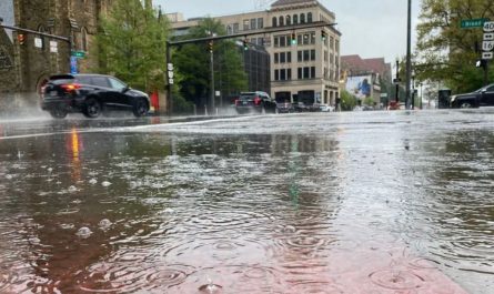
According to the National Weather Service, the heaviest rainfall is expected Saturday afternoon, with wet conditions lingering into Sunday.
Rainfall totals could be significant
Forecasters expect moderate to heavy rainfall, especially in foothill and mountain communities.
Expected rainfall totals through Sunday include:
- 1 to 3 inches across coastal and valley areas
- 3 to 6 inches in foothills and mountain regions
Rainfall rates may become intense at times, raising concerns about runoff and flash flooding.
Peak storm timing and wind impacts
The National Weather Service outlined the most impactful periods of the storm, noting that timing could shift slightly.
Key storm details (Friday through Sunday night):
- Peak timing:
- Saturday 3 a.m. to 6 p.m.
- Sunday 10 a.m. to 10 p.m. (±6 hours)
- Peak rain rates: 0.25 to 0.50 inches per hour, with isolated rates up to 0.75 inches per hour
- Peak wind gusts: 20 to 40 mph, with isolated gusts reaching 60 mph
Strong winds could lead to downed tree limbs, power outages, and difficult travel, especially in exposed and mountainous areas.
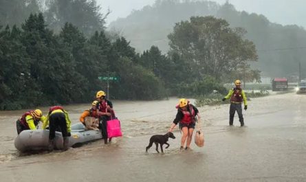
Burn scar flooding remains a concern
Forecasters are particularly concerned about recent wildfire burn scars, where heavy rain can quickly trigger mudslides and debris flows.
“A flash flood watch may need to be considered later today when the timing and amounts become a little more firm,” the National Weather Service said.
Residents near burn areas are urged to stay alert for evacuation notices and avoid flood-prone roadways.
Read Also: San Diego’s Only Sprinkles Cupcakes Store in La Jolla Closes as Chain Shuts Down
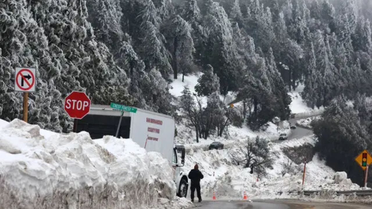
Mountain snow expected at higher elevations
Colder air associated with the storm will bring snow to Southern California’s highest elevations.
- Snow levels: Above 6,500 feet, with a rain-snow mix possible near 6,000 feet
- Accumulation: Up to one foot of snow possible at the highest mountain peaks
Mountain passes could become slick or snow-covered, making travel dangerous through the weekend.
Wet pattern continues into next week
The unsettled weather is not expected to end with the weekend. Forecasters say there is another chance of rain Monday and Tuesday, though that system is expected to be drier and colder than the weekend storm.
Despite slightly lower rainfall totals next week, saturated ground means even lighter rain could still cause localized issues.
What residents should prepare for
Officials recommend Southern Californians take precautions ahead of the storm:
- Avoid driving through flooded roadways
- Monitor alerts if living near burn scars or foothills
- Secure outdoor items ahead of strong winds
- Prepare for mountain travel restrictions
- Allow extra travel time this weekend
Staying informed
Weather conditions may change rapidly as the storm approaches. Residents are encouraged to monitor updates from the National Weather Service and local emergency officials throughout the weekend.
Are you seeing rain or preparing for mountain snow where you live? Share what conditions look like in your area in the comments, and help others stay informed as Southern California braces for another round of winter weather.