 by
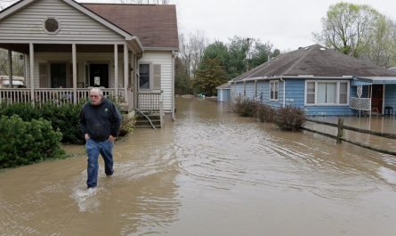
by Chicago, Illinois — After days of bone-chilling Arctic air gripping much of the country, a noticeable shift in the weather pattern is finally taking shape. Meteorologists say the central and eastern United States will begin warming this week, offering relief from a deep freeze that pushed temperatures well below normal and raised widespread frostbite concerns.
While the coldest conditions will linger into Monday for some areas, forecasters agree that the worst of this Arctic outbreak is nearing its end.
Arctic air delivers record cold to large swath of the U.S.
According to Weather meteorologists, locations stretching from the Plains through the Midwest, Great Lakes, Northeast, and Mid-Atlantic experienced record or near-record low high temperatures, running 20 to 30 degrees below typical December averages.
The surge of Arctic air, paired with gusty winds in several regions, created dangerous conditions for outdoor workers, schoolchildren waiting at bus stops, and pets. In many cities, temperatures struggled to climb out of the teens, while wind chills dropped well below zero.
Forecasters say the coldest air mass will slowly retreat beginning late Monday, as the jet stream pattern shifts and allows milder air to move east.
How this cold compares to recent winters
So far this month, many major cities across the central and northeastern U.S. have averaged 7 to 10 degrees colder than normal. Some Midwestern cities have seen even sharper departures.
Places like Duluth, Minnesota, and Green Bay, Wisconsin have recorded temperatures more than 12 degrees below historical December averages, placing this stretch among the coldest starts to winter in recent years.
That contrasts sharply with last December, when many of the same regions were warmer than average. Cities such as Detroit and the Twin Cities finished December 2024 about 2 to 3 degrees above normal, highlighting just how abrupt this winter’s shift has been.
Despite the intensity, meteorologists stress that this cold blast is not expected to persist much longer.
Read Also: Milder Conditions Likely to Spread Across the U.S. Ahead of Christmas, Forecasts Indicate
Widespread frostbite risk remains through Monday
Even as temperatures begin to moderate, dangerously cold wind chills remain a concern through Monday morning in parts of the Midwest, Great Lakes, and Northeast.
“In Detroit, RealFeel® Temperatures can be as low as minus 5 to minus 10 Monday morning,” According to AccuWeather. “That level of cold can cause frostbite within minutes on exposed skin.”
Residents are urged to limit time outdoors, dress in layers, and ensure pets and vulnerable neighbors are protected until conditions improve.
Noticeable warm-up arrives midweek
As the week progresses, temperatures are expected to climb steadily across much of the region. While early-week highs will still run cool, many areas will return to near or slightly above seasonal averages by midweek.
In cities like Detroit, afternoon highs near 20 degrees on Monday are forecast to rise into the upper 30s and near 40 by Wednesday, with some locations reaching the mid to upper 40s by Thursday.
Similar warming trends are expected across the Ohio Valley, Mid-Atlantic, and parts of the Northeast, easing energy demand and improving travel conditions.
Meteorologists say the Arctic air mass will retreat northward, replaced by a more west-to-east jet stream flow that favors milder Pacific air.
What the warm-up means for snow and holiday plans
While the warming trend will be welcomed by many, it may come at a cost for those hoping for a White Christmas.
With temperatures rising later this week, existing snow cover across parts of the Midwest — especially areas away from the Great Lakes — may begin to melt. Any snowfall that does occur could struggle to stick around long enough to survive through Christmas Day.
Forecasters note that while colder air will still be present at times later in December, the upcoming pattern is less favorable for prolonged snow cover in lower-elevation and southern areas of the central and eastern U.S.
Cold not gone for good, but extremes ease
Meteorologists emphasize that winter is far from over. Additional cold snaps are likely as the season progresses, but the severity of this particular Arctic outbreak is not expected to repeat immediately.
For now, the transition to more moderate temperatures should provide a much-needed break after days of extreme cold.
Residents are encouraged to continue monitoring local forecasts, especially as the pattern evolves closer to Christmas.
Do you welcome the warmer weather, or were you hoping the deep freeze would bring a white Christmas to your area? Share your thoughts and local conditions in the comments.