 by
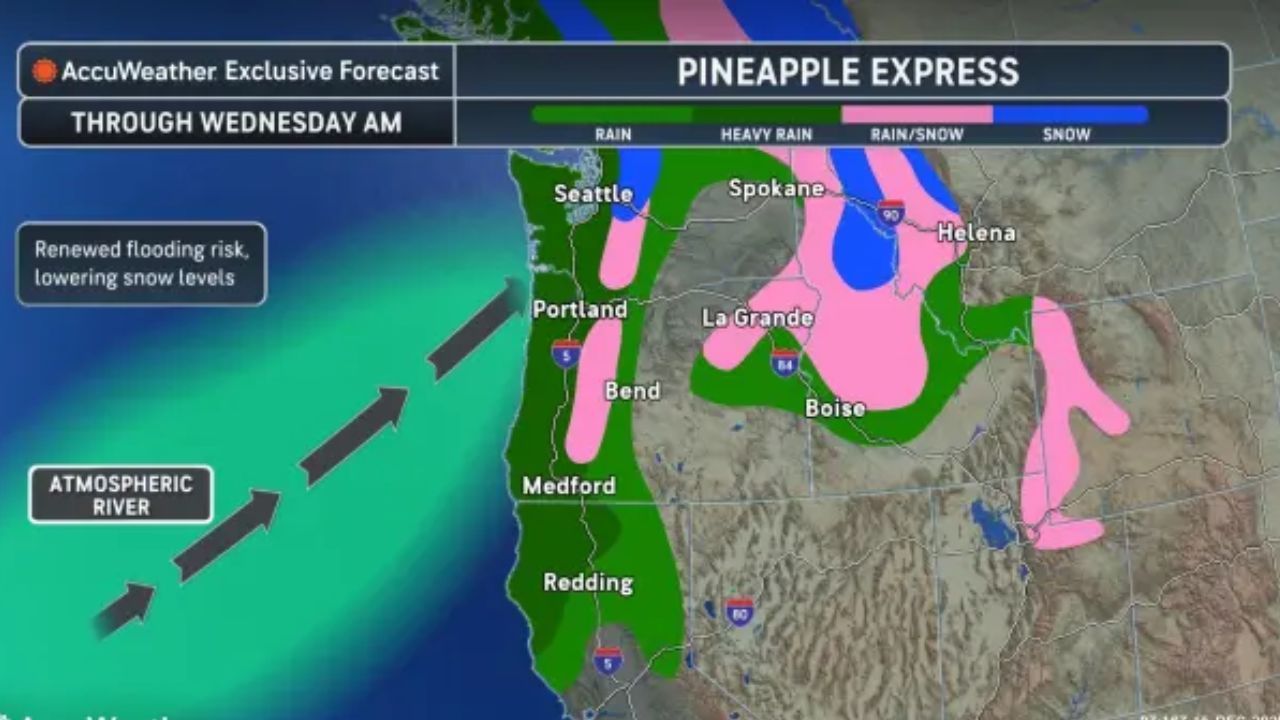
by Seattle, Washington — A powerful Pineapple Express weather system is lining up to impact the Pacific Northwest this week, raising concerns about dangerous flooding, mudslides, river surges, and damaging winds across Washington, Oregon, and parts of Northern California. Forecasters warn that the incoming system will arrive on the heels of already saturated ground, significantly increasing the risk of major and potentially historic flood impacts.
The National Weather Service and private forecasters say this will not be a quick-moving storm. Instead, repeat rounds of heavy rain are expected from Monday through early Wednesday, with additional systems possible later in the week.
What makes this Pineapple Express especially concerning
The Pineapple Express is a type of atmospheric river that pulls warm, moisture-rich air from near Hawaii and directs it straight into the Pacific Northwest. These systems are capable of producing long-duration, high-volume rainfall, especially when they stall or repeatedly redevelop over the same region.
This week’s event follows back-to-back atmospheric rivers that have already dumped more than a month’s worth of rain in just days in some locations. Rivers are still running high, soils are saturated, and hillsides remain unstable — a dangerous setup for what’s coming next.
Forecasters say this Pineapple Express will be strong enough to sustain heavy rain for multiple days, rather than just hours.
Timeline: When the heaviest rain arrives
The storm is expected to begin impacting the region Monday, intensifying through Tuesday, and gradually easing by Wednesday morning. However, meteorologists stress that impacts will linger well beyond the end of rainfall.
Repeat bands of rain will target:
- Western Washington
- Western and central Oregon
- Northwest California
Even during brief lulls, runoff will continue flowing into rivers, meaning flooding may worsen after the rain slows or stops.
Rainfall totals and high-risk terrain
The highest rainfall totals are expected in upslope and mountainous regions, where terrain forces moisture upward, intensifying precipitation.
Forecast totals include:
- 2 to 4 inches of rain in the Olympic Mountains, Coastal Range, and Cascades
- Localized amounts over 4 inches on windward slopes
Lower elevations, including urban corridors, are also expected to see multiple inches of rain, which could overwhelm drainage systems and lead to street flooding.
Flooding and mudslide danger increasing rapidly
With soils already saturated, even moderate additional rainfall can trigger major impacts. Forecasters say the threat for mudslides and landslides will increase sharply, especially in steep terrain, burn scar areas, and locations that experienced recent slope failures.
Rivers that recently crested at or near record levels could rise again. Some may take several days to reach peak levels, meaning the flood threat could extend into the latter half of the week.
Officials are urging residents in flood-prone zones not to let their guard down during breaks in the rain, as water levels may still be rising downstream.
Snow levels drop as colder air moves in
While much of the precipitation will fall as rain initially, snow levels are expected to drop Monday night, particularly in Washington.
Forecasters say accumulating snow could reach elevations as low as 4,000 feet, impacting areas such as Stevens Pass. From Tuesday night into Wednesday morning, a cooler push of air could bring more widespread mountain snow, complicating travel through high-elevation passes.
This rain-to-snow transition can worsen flooding by accelerating runoff before colder air fully settles in.
Powerful winds to add to midweek hazards
As the system moves ashore late Tuesday, strong and potentially damaging winds are expected to develop.
Forecast highlights include:
- Coastal wind gusts near 50 mph
- Inland gusts exceeding 60 mph in parts of Washington, Oregon, Idaho, Montana, and Wyoming
- Elevated crosswind risks along Interstates 25, 90, and 94
High-profile vehicles may face dangerous travel conditions, and downed trees or power lines are possible, especially in areas with waterlogged soil.
Read Also: NWS Warns of 3–10 Inches of Snow Across Indiana, Ohio, Pennsylvania This Weekend
Travel disruptions likely across the region
The combination of flooded roads, landslides, snow-covered passes, and strong winds could lead to widespread travel disruptions.
Forecasters warn of potential impacts along:
- Interstate 5 from Portland to Medford
- Mountain passes across the Cascades
- Coastal highways vulnerable to wind and flooding
Drivers are urged to avoid flooded roadways and to stay alert for rapidly changing conditions.
More storms waiting in the wings
Unfortunately, this Pineapple Express does not signal the end of active weather. After a brief break midweek, another storm system is expected to move into the Pacific Northwest later in the week, bringing additional rain and mountain snow.
Parts of Oregon, in particular, could face renewed flooding concerns as rainfall continues to stack up on already soaked ground.
Forecasters caution that cumulative impacts — rather than a single storm — may ultimately produce the most severe outcomes.
What residents should do now
Emergency officials urge residents to:
- Monitor local forecasts and river gauges closely
- Prepare for possible evacuation if living in flood-prone areas
- Avoid unnecessary travel during peak storm periods
- Secure loose outdoor items ahead of strong winds
This week’s Pineapple Express has the potential to be one of the most impactful weather events of the season for the Pacific Northwest.
Have you already seen flooding or damage from recent storms in your area? Share what conditions look like where you live in the comments below.