by
by New York City, New York — As the first wave of Christmas and holiday travel begins, a developing storm system is expected to create hazardous travel conditions across large portions of the central and eastern United States, potentially disrupting road and air travel during one of the busiest weeks of the year.
With millions of Americans preparing to travel for Christmas and Hanukkah, forecasters warn that rain, dense fog, gusty winds, and isolated ice could complicate trips from the Midwest to the East Coast between Tuesday night and Thursday.
Record Holiday Travel Meets Unstable Weather
According to AAA, a record 122.4 million people are expected to travel more than 50 miles between December 20 and New Year’s Day, making weather disruptions especially impactful.
As universities wrap up fall semesters and families hit the roads and airports, the timing of this storm places it directly in the path of peak travel days.
Meteorologists say the system originates from the Pacific Northwest, where it is expected to cause renewed flooding and disruptions in Washington and Oregon, before sweeping eastward across the country.
Warmer Air Replaces Arctic Cold, Creating New Hazards
An unusual weather pattern is allowing Arctic air to retreat more easily than normal, clearing the way for warmer, moisture-rich air to surge into colder regions.
High pressure is forecast to slide offshore from the mid-Atlantic, rather than lingering over Atlantic Canada, reducing resistance from cold air masses. While this will melt existing snow in many areas, it also introduces new problems.
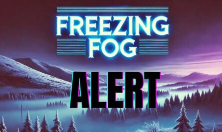
As warm, moist air moves over cold ground and lingering snowpack, forecasters warn of fog, drizzle, and freezing moisture, particularly on untreated surfaces.
Ice and Fog Threats in the Great Lakes and Northeast
Parts of the Great Lakes region could see fog and freezing drizzle Tuesday night into Wednesday morning, especially where cold surfaces remain.
While widespread ice is not expected, localized slick spots may form, creating dangerous driving conditions during overnight and early-morning hours.
Wind ahead of the storm may limit fog development in some areas, but in locations where winds are lighter, low visibility could become a serious concern.
Further east, pockets of lingering cold air in the Appalachians, northeastern New York, and northern New England may allow early rainfall to freeze on contact, increasing the risk of icy roads and walkways.
Read Also: First Measurable Snow Falls Across New York and Northeast Cities, Marking Start of Winter
Rain, Wind, and Airline Delays Expected Midweek
From Wednesday through Thursday evening, travelers can expect widespread rain stretching from the Mississippi Valley to the Appalachians, followed by rain reaching much of the Atlantic Seaboard Thursday night.
The combination of wet highways, slick runways, gusty winds, and reduced visibility is likely to trigger flight delays and cancellations, especially at major East Coast and Midwest airports.
Actual temperatures are forecast to climb into the 40s, 50s, and even low 60s in some regions. However, strong winds could make conditions feel 10–15 degrees colder, increasing discomfort for travelers waiting outdoors or facing delays.
Flooding Risk Where Snow Is Melting
In areas where snow remains piled up, localized street flooding is possible. Meteorologists warn that blocked storm drains, combined with rain and rapid snowmelt, could overwhelm drainage systems in some cities.
Urban areas with older infrastructure may be particularly vulnerable to brief but disruptive flooding.
Cold Returns Before Christmas Weekend
Behind the storm, a new surge of cold air is expected to sweep in from the northern Plains and Midwest on Friday, reaching the Northeast by Friday night and Saturday.
While many roads may dry as colder air arrives, forecasters caution that rain could briefly change to snow in parts of the Appalachians late Thursday night into Friday, potentially catching travelers off guard.
A period of lake-effect snow is also expected from Thursday night through Friday night, especially in Michigan, western and northern New York, and northwestern Pennsylvania, where driving conditions could deteriorate rapidly.
Travel Outlook Remains Uncertain
Gusty winds associated with the departing storm and incoming cold air could continue to cause airline delays in the Midwest and Northeast through Friday.
With weather conditions changing quickly during a critical travel window, travelers are urged to monitor forecasts closely, allow extra travel time, and remain flexible with plans.
As the holiday rush ramps up, this storm serves as a reminder that even without major snowstorms, rain, fog, wind, and ice can pose serious travel risks.
Are you traveling this week, and how are weather conditions affecting your plans? Share your experience in the comments below.