 by
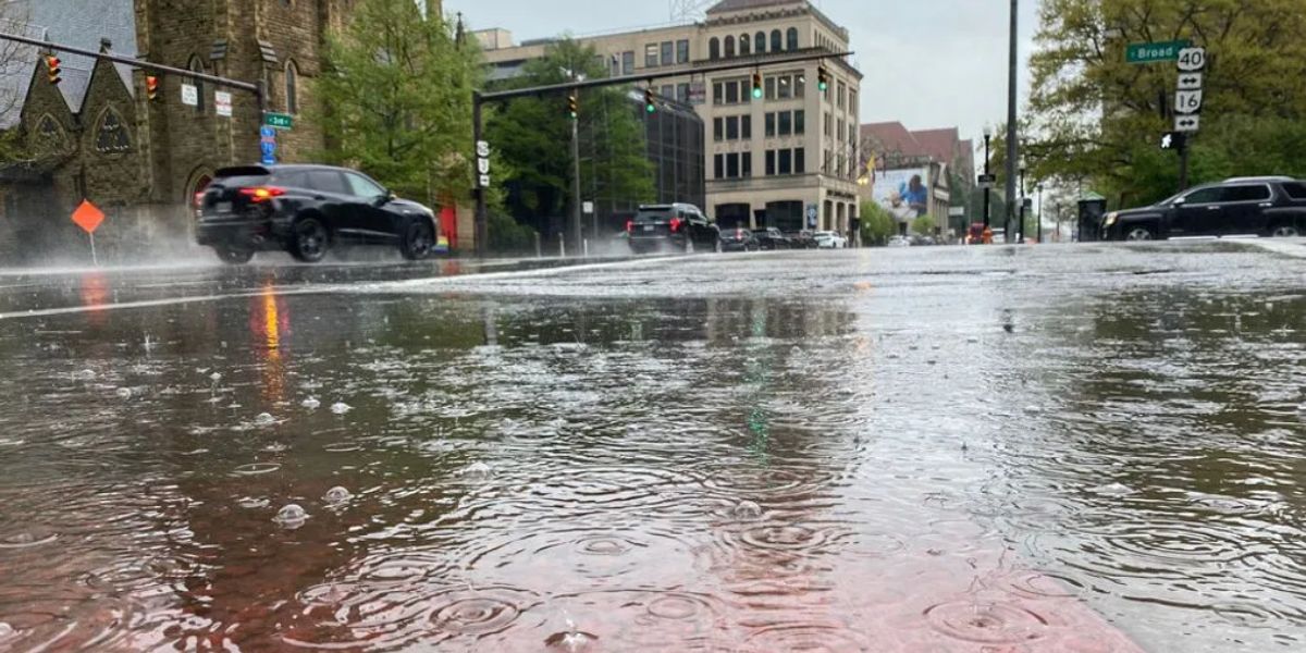
by A round of significant rainfall moved through the Ohio Valley from late Wednesday into Thursday morning, pushing several rivers across northern Ohio and central Indiana to near bankfull levels. The National Weather Service Ohio River Forecast Center is closely monitoring the situation, though major flooding is not anticipated at this time.
Between 2 and 3 inches of rain fell overnight in parts of the northwest Ohio Valley, particularly in northern Ohio and northern and central Indiana. The rain, which was widespread and intense at times, caused a noticeable rise in river levels. Several river gauges are now reporting water levels near or slightly above bankfull, the point at which water begins to spill into adjacent low-lying areas. While only minor flooding has been reported so far, isolated impacts may continue Thursday as drainage continues through local waterways.
The areas most affected are primarily rural communities, low-lying farmland, and other flood-prone zones along small rivers and creeks. Urban flooding has been limited, but residents in flat or poorly drained locations near waterways are urged to remain alert for potential water level changes.
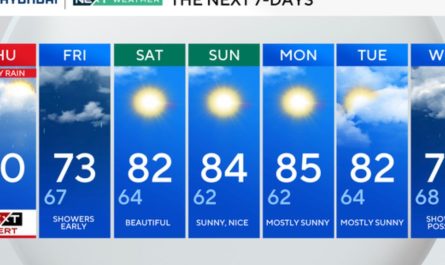
Additional showers and thunderstorms are forecast throughout Thursday, which could lead to brief surges in river levels. However, meteorologists say the worst of the rainfall has already passed, and the risk of major flooding remains low.
By Friday, a cooler and drier air mass is expected to arrive across the region, bringing an end to the recent rainfall and allowing rivers to slowly recede. This transition will lead to more stable hydrologic conditions heading into the weekend.
Despite the improving outlook, authorities warn that isolated trouble spots could still develop, particularly along smaller streams where the ground remains saturated. Residents in flood-prone zones should continue to monitor local weather updates, follow any issued alerts, and avoid walking or driving through flooded roads or fields.
Officials also recommend that homeowners check sump pumps, secure outdoor belongings, and review emergency plans, especially in communities with a history of flood issues.
While Thursday may bring some lingering showers, drier conditions are expected to dominate the weekend forecast, giving affected areas a chance to recover from the excess water and return to normal by early next week.