Cincinnati, Ohio — A significant winter storm is set to impact large portions of the Ohio Valley and western Pennsylvania this weekend, prompting Winter Storm Warnings across parts of Indiana, Ohio, Pennsylvania, northern Kentucky, and West Virginia, according to multiple National Weather Service (NWS) offices.
Forecasters warn that the storm could bring widespread snowfall totals ranging from 3 to 10 inches, along with dangerous travel conditions, reduced visibility, and rapidly deteriorating roadways from Saturday afternoon through Sunday.
Winter Storm Warnings span multiple states
The warning covers a broad corridor stretching from southeast Indiana and northern Kentucky, through central and southern Ohio, into eastern Ohio, western and southwest Pennsylvania, and parts of West Virginia.
While the timing and snowfall totals vary by location, officials agree that this will be a high-impact, long-duration event, especially for weekend travel and overnight commuters.
Snow totals vary west to east
According to the National Weather Service, southeast Indiana, northern Kentucky, and southwest to central Ohio are forecast to receive 3 to 5 inches of snow. In these areas, the warning is in effect from 1 p.m. Saturday through 7 a.m. Sunday.
Farther east, snowfall totals are expected to be more substantial. The NWS Pittsburgh office is forecasting 6 to 10 inches of snow across eastern Ohio, western Pennsylvania, and the northern panhandle of West Virginia, with the warning extending through 1 p.m. Sunday.
Forecasters caution that localized higher totals are possible where stronger snow bands develop and linger.
Higher elevations face prolonged impacts
Additional Winter Storm Warnings extend north and south of the primary corridor, particularly across portions of West Virginia.
In these areas, snowfall totals are projected to range from 4 to 10 inches, with higher elevations potentially seeing snow continue into late Sunday or early Monday.
Officials say mountainous terrain could enhance snowfall rates and prolong hazardous travel conditions well after the storm exits lower elevations.
Dangerous travel conditions expected
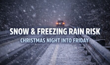
The National Weather Service warns that travel conditions will worsen rapidly Saturday evening, especially after sunset as snowfall rates intensify.
Read Also: Small Sunday Rain Chance, Big Cold Change—Columbia Prepares for Frosty Nights
In some areas, snowfall rates could reach one inch per hour, significantly reducing visibility and making roads slick in a short period of time.
NWS officials caution that visibility may drop below one-quarter mile in heavier snow bursts, while bridges and overpasses could ice over quickly due to falling temperatures.
Saturday night into Sunday morning most hazardous
The most dangerous travel window is expected from Saturday evening through early Sunday morning, when snow is falling steadily and road crews may struggle to keep up with accumulation.
Drivers are urged to delay non-essential travel if possible and to allow extra time for any necessary trips. Officials emphasize that road conditions can deteriorate rapidly, even on previously treated highways.
Impacts on weekend schedules possible
With warning end times varying by region, the storm could disrupt overnight work shifts, student travel, weekend commuters, and early Sunday plans.
Those traveling between states may encounter drastically different conditions over short distances, increasing the risk of accidents.
Residents are encouraged to plan ahead, charge mobile devices, and keep emergency supplies in vehicles in case of delays.
Officials urge residents to stay informed
Emergency managers and weather officials are advising residents to closely monitor updates from local NWS offices, as well as state and local road information portals, as snowfall bands may shift and alter local impacts.
Even modest changes in storm track could significantly affect snowfall totals in certain areas.
As the storm approaches, officials stress that preparation and awareness are key to staying safe during what could be one of the most impactful winter weather events of the season for the region.
How much snow are you expecting in your area, and are roads already becoming slick? Share your local conditions and plans in the comments below.


