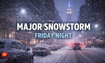
Columbus, Ohio — A fast-moving winter storm is set to sweep across a wide stretch of the United States this weekend, bringing slippery roads, travel delays, and accumulating snow from the Midwest to the Northeast.
Forecasters say the system will ride the coldest Arctic air of December so far, creating hazardous conditions from Interstate 70 in the Ohio Valley to Interstate 95 along the East Coast from Saturday into Sunday.
According to meteorologists, the storm will impact a 1,500-mile corridor, stretching from the northern Plains through the Ohio Valley and into southern New England, with snowfall totals varying significantly by region.
Snow spreads from the Midwest into the Northeast
The weekend system is expected to deliver 1 to 6 inches of snow across much of its path, with the most consistent impacts along I-70, including parts of Illinois, Indiana, Ohio, and West Virginia, before shifting eastward toward I-95, affecting major metro areas from Maryland to Massachusetts.
Forecasters say snow will begin Saturday afternoon in parts of the Midwest before expanding east Saturday night and early Sunday. While the storm is fast-moving, the combination of cold air and steady snowfall is expected to quickly degrade travel conditions.
Airports along the storm track may also see delays and cancellations, particularly in the Ohio Valley and the Northeast, as snow coincides with peak weekend travel.
Break in snow expected along I-81 corridor
Not every region will see significant accumulation. A relative break in snowfall is expected along the Interstate 81 corridor, stretching from south-central Pennsylvania through Virginia.
In this zone, forecasters expect a dusting to about 1 inch of snow, mainly late Saturday night. While impacts here should be limited, isolated slick spots may still develop as temperatures fall overnight.
Roads may start wet, then turn icy fast
Because the storm arrives with Arctic air pressing south, conditions may be deceptive at the start, especially along the I-95 corridor.
In cities such as Washington, D.C., Baltimore, Philadelphia, New York City, and Boston, roads may initially be wet or slushy as precipitation begins. However, forecasters warn that temperatures will drop during the storm.
As colder air deepens, any rain or wintry mix will quickly change to snow, and road conditions could deteriorate rapidly.
Streets are expected to transition from wet to slush to snow-covered, with ice possible in spots, particularly on bridges and overpasses.
Moderate snowfall targets Ohio Valley and nearby regions
The most likely area for plowable and shovel-worthy snow extends from central Iowa through West Virginia.
Within this corridor, 3 to 6 inches of snow is forecast, enough to cause widespread travel disruptions. Cities at risk for moderate snowfall include Peoria, Illinois; Indianapolis and Columbus, Ohio; Pittsburgh, Pennsylvania; and Charleston, West Virginia.
Another pocket of similar snowfall totals is expected just south and east of Philadelphia, as well as east of Baltimore, impacting parts of Delaware and southern New Jersey.
Forecasters also expect 3 to 6 inches on eastern Long Island and Cape Cod, Massachusetts, where snow could linger into Sunday morning.
Heaviest snow expected in higher elevations
The highest snowfall totals are expected in the mountain regions of West Virginia, western Maryland, and southwestern Pennsylvania.
In these areas, forecasters say up to a foot of snow could accumulate, creating especially hazardous travel conditions and the potential for extended impacts into Sunday.
Residents in higher elevations are urged to prepare for longer-lasting snow cover and slower road clearing compared to lower-lying areas.
Arctic cold follows the storm
Once the snow exits, brutal Arctic cold will follow closely behind.
Temperatures are expected to plummet Saturday and Sunday nights across the Midwest, with lows well below zero in many locations and double-digit below-zero readings possible in some areas.
In the Northeast, overnight lows will range from near zero in the Appalachians to the teens along I-95.
This level of cold raises concerns beyond travel.
Risk of frozen pipes and record lows
Forecasters warn that temperatures may fall low enough to pose a risk of frozen and burst pipes, even in parts of the Southeast, including areas near the central Gulf Coast and southern Atlantic coast, north of Florida.
Daily record low temperatures may be challenged from the Midwest to the Southeast, with some locations experiencing their coldest air since last winter, or colder than the entire previous winter season.
Read Also: NWS Warns of 3–10 Inches of Snow Across Indiana, Ohio, Pennsylvania This Weekend
Cold won’t last long, forecasters say
Despite the severity of the cold, meteorologists say the worst conditions will be short-lived.
“If it is any consolation, the Arctic blast will leave quickly, with the worst conditions only lasting a little over 24 hours,” said AccuWeather Senior Meteorologist Brett Anderson.
A significant warmup is expected across much of the central and eastern United States next week, helping to ease the bitter cold.
For now, drivers and travelers are urged to slow down, allow extra time, and limit unnecessary travel during the storm’s peak.
How much snow and cold are you expecting in your area this weekend? Share your local conditions and plans in the comments below.


